First Release of Python Bindings to OpendTect
The 6.6.8 release of the WMPlugins includes a Python module, wmodpy, to access OpendTect survey and well information. Unlike OpendTect’s existing odpy module, wmodpy is a direct binding to the OpendTect C++ code.
The odpy module, by comparison, uses a command line application to interact with the OpendTect data structures and transfers data to Python as an ascii data stream. This incurs the overhead of starting this application and the writing and reading of an ascii data stream on every request. The wmodpy module, however, as a direct binding to the OpendTect C++ code allows Python to directly read from the in-memory representation of the data. Data access with the wmodpy module should be much faster.
Accessing the wmodpy Module
Installing my WMPlugins using the OpendTect installation manager will install the wmodpy Python module into the bin/win64/Release or bin/lux64/Release subfolder of the OpendTect software. You also need a Python environment with at least Numpy but additional output options exist if the environment also has Pandas. The OpendTect machine learning Python environments already include Numpy and Pandas. For map display you may want to add a module like Folium to your working environment.
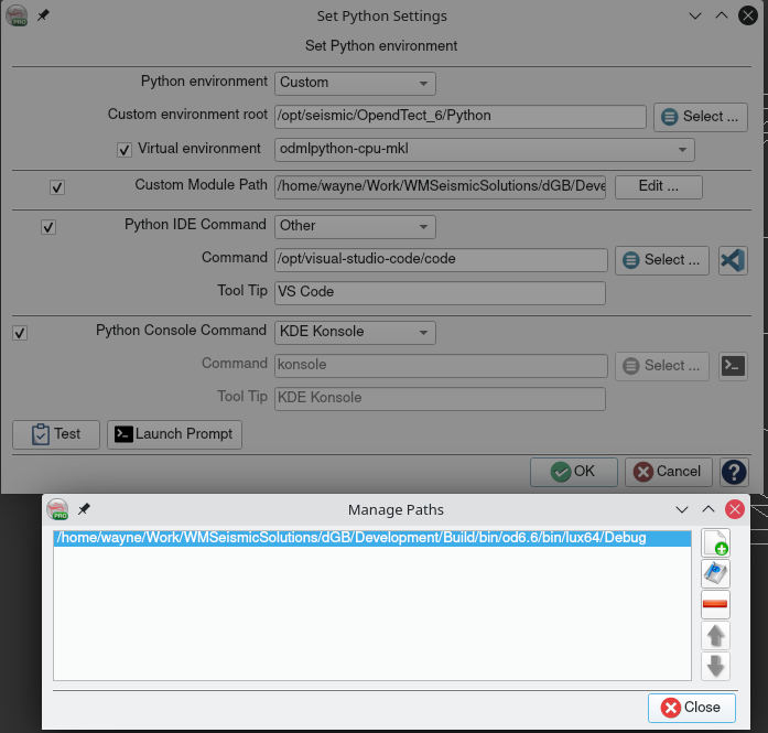
The folder containing the bindings library must be on the PYTHONPATH to be found by an import statement in a Python script or notebook. You can either use the OpendTect Python Settings dialog (accessible from the Utilities| Installation|Python Settings application menu) and add the location of the OpendTect executable files to the Custom Module Path or modify the PYTHONPATH within the script.

OpendTect Python Settings Dialog
The OpendTect Python Settings dialog also allows you to select a custom Python environment to use and also add an icon to the OpendTect toolbar to start your chosen IDE and console (only OpendTect 6.6.4) with the specified custom Python environment activated and the Custom Module Paths added to the PYTHONPATH.
The alternative script/notebook based solution requires something like the following at the top of the script:
import sys
sys.path.insert(0, 'C:/Program Files/OpendTect/6.6.0/bin/win64/Release')
import wmodpy
General Survey Information
The module includes a number of functions for getting information about OpendTect surveys/projects. These all require an OpendTect data root folder for context.
| Command | Description |
|---|---|
| get_surveys(data_root:str) | Return list of survey names in the given data_root |
| get_survey_info(data_root:str, surveys:list) | Return a Python dictionary with basic information for the surveys in the given list or all surveys if no list is given |
| get_survey_info_df(data_root:str, surveys:list) | Return a Pandas Dataframe with basic information for the surveys in the given list or all surveys if no list is given |
| get_survey_features(data_root:str, surveys:list) | Return a GeoJSON Feature Collection with basic information for the surveys in the given list or all surveys if no list is given |
Some examples:
wmodpy.get_surveys("/mnt/Data/seismic/CooperBasin/ODData")
['13CP06_Dundinna', 'Cooper2D']
wmodpy.get_surveys_df("/mnt/Data/seismic/ODData", ["F3_Demo_2020", "Penobscot"])

Displaying OpendTect survey info in a Pandas Dataframe

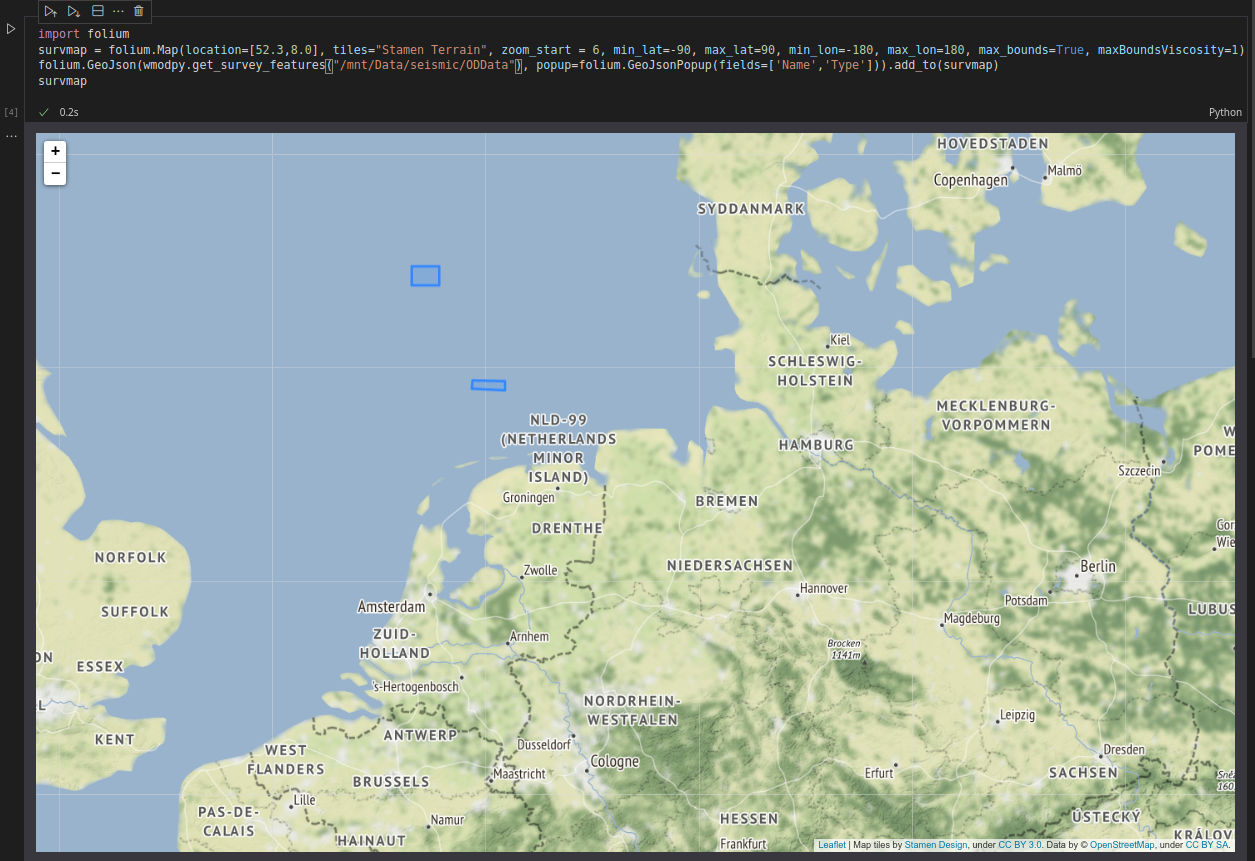
Displaying OpendTect survey locations on a Folium web map
Survey Class
The module adds a Survey Python class. Create a Survey object for a particular data_root and survey_name combination like this:
f3demo = wmodpy.Survey("/mnt/Data/seismic/ODData", "F3_Demo_2020")
The Survey object can then be used to get information about the survey:
f3demo.info()
{'Name': ['F3 Demo 2020'], 'Type': ['2D3D'], 'crs': ['EPSG:23031']}
To get a full list of methods provided by the Survey class use :
help(wmodpy.Survey)
The other classes added by the module generally require a Survey object for context.
Wells Class
The Wells Python class provides methods to access OpendTect well data within a survey. Creating a Wells object requires a Survey object for context:
f3demo_wells = wmodpy.Wells(f3demo)
Methods are provided to:
- List the names of all wells in the project/survey
- List summary information on all wells
- List well log information in a well
- List well log data
- List markers in a well
- List a well track
There is also a “features” method that returns a GeoJSON Feature Collection. To get a full list of methods provided by the Wells class use:
help(wmodpy.Wells)
You will notice that in many cases the same data can be obtained as either a Python dictionary or as a Pandas Dataframe. Methods returning a Pandas Dataframe have a suffix of “_df”.
f3demo_wells.info()
{'Name': ['F02-1', 'F03-2', 'F03-4', 'F06-1'],
 'UWID': ['', '', '', ''],
 'State': ['', '', '', ''],
 'County': ['', '', '', ''],
 'WellType': ['none', 'none', 'none', 'none'],
 'X': [606554.0, 619101.0, 623255.98, 607903.0],
 'Y': [6080126.0, 6089491.0, 6082586.87, 6077213.0],
 'ReplacementVelocity': [2000.0, 2000.0, 2000.0, 2000.0],
 'GroundElevation': [1.0000000150474662e+30,
  1.0000000150474662e+30,
  1.0000000150474662e+30,
  1.0000000150474662e+30]}
f3demo_wells.info_df()

Displaying OpendTect well info in a Pandas Dataframe
Getting well log data in a Pandas Dataframe is as easy as:
f3demo_wells.log_data_df('F02-1',['Vp','Sonic'],0.15, wmodpy.Wells.SampleMode.Upscale)

Displaying OpendTect well logs in a Pandas Dataframe