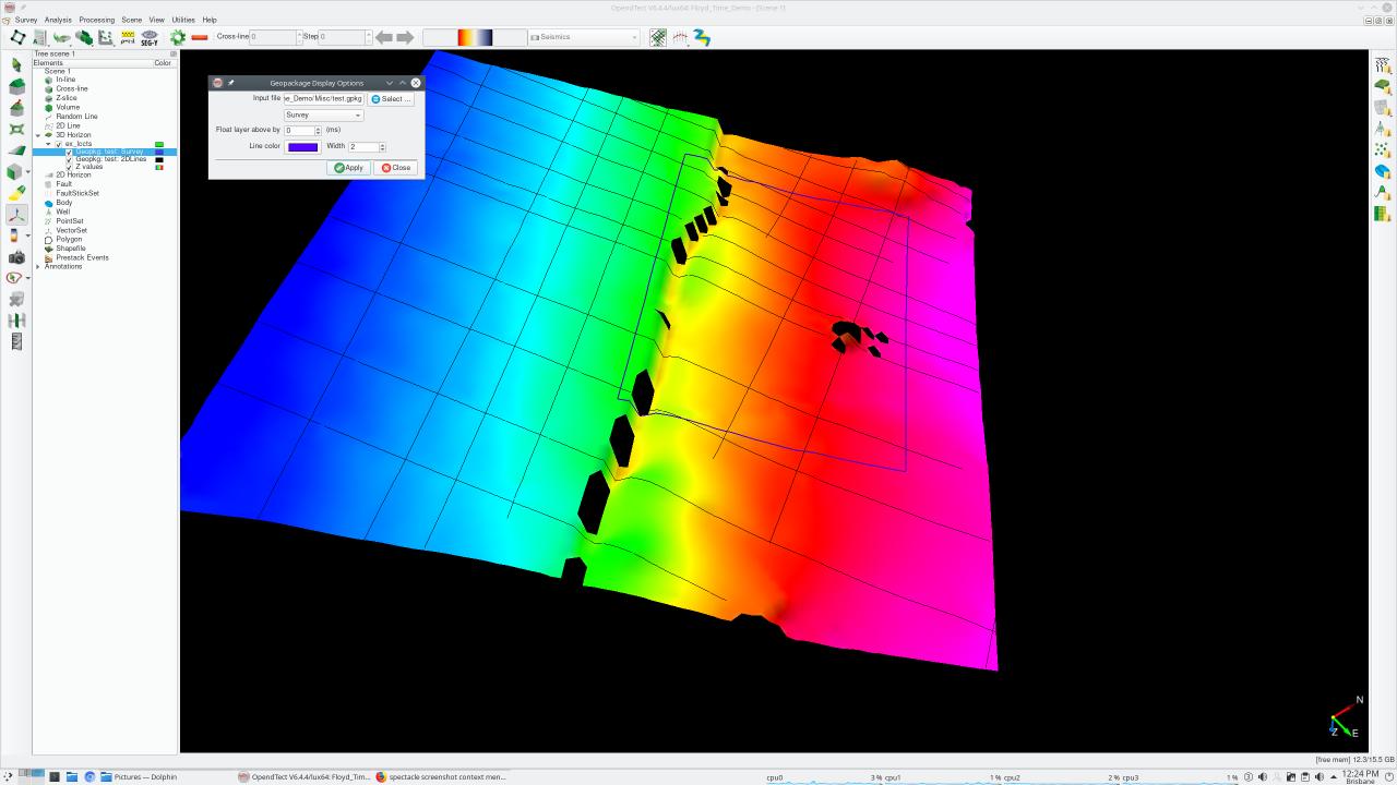
This is an extension of the GeopackageExport plugin that displays lines and polylines from a Geopackage database file over an OpendTect 3D horizon.
Description
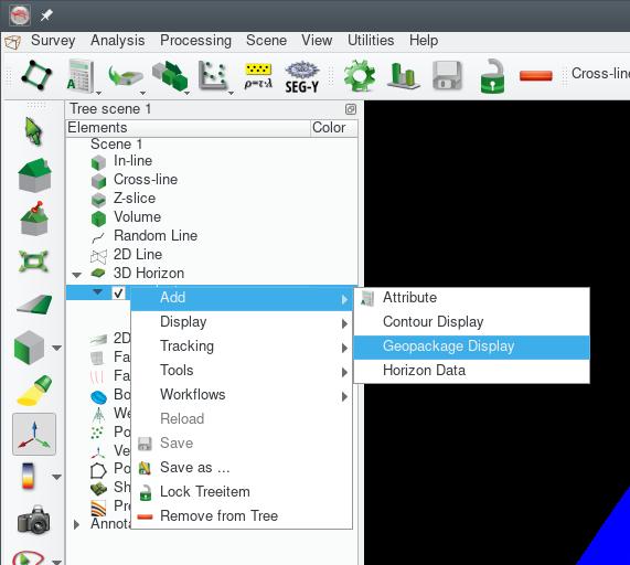
The plugin adds a "Geopackage Display" item to the "Add" context menu of 3D Horizons in the scene tree. Selecting the item opens a dialog box for selecting the Geopackage file, the layer to display and the line color and width. Multiple layers can be displayed.
Notes
- The plugin requires the survey to have a projection based CRS defined.
- This plugin is actually part of the GeopackageExport plugin - see notes there as well