This plugin, for the open source seismic interpretation platform OpendTect Version 6.4.0 or later, exports OpendTect 3D horizon and attribute data to a GeoTIFF image. GeoTIFF is a public domain metadata standard which allows georeferencing information to be embedded within a TIFF image file. GeoTIFF image files are widely supported by GIS software.
Description
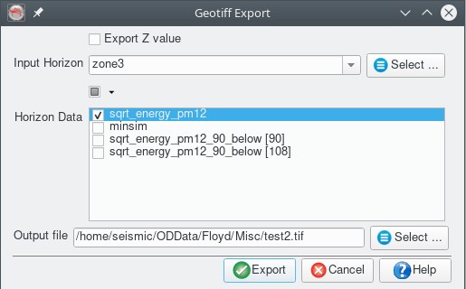
The plugin adds a "Geotiff Export" item to the Survey-Export main menu. Selecting the item opens a dialog box for selecting the 3D horizon and attributes to export and the destination file name. The horizon Z values and attributes values are exported to Float32 bands in the output image. The plugin supports exporting multiple attributes to a single GeoTIFF file, however some GIS packages may not have the flexibility to display individual bands from a Float32 multiband image (eg QGIS v3.6). If multiband images prove to be a problem the option exists to run the plugin multiple times and save each attribute to a separate GeoTIFF file.
Notes
- The plugin requires the survey to have a projection based CRS defined.
- This plugin is actually part of the GeopackageExport plugin - see notes there as well
Input Parameters